Through river monitoring we assess the input of freshwater (river discharge) into Almirante Bay
|
We are monitoring rivers with varying land-use and environmental conservation. Black River and the Changuinola Canal are intertidal streams within San San Pond Sak, a peat swamp. Nigua, Oeste, and Pastores are small mountain catchment rivers with varying levels of degradation, with human settlements and some agriculture. The Changuinola river is the third largest river in Panama and is located in the neighbouring catchment. Although this river drains into the ocean, the large volume of freshwater and nutrients may travel east along the coast and enter Almirante Bay.
|
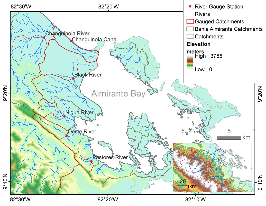
Six monitored river catchments in Almirante Bay
|
|
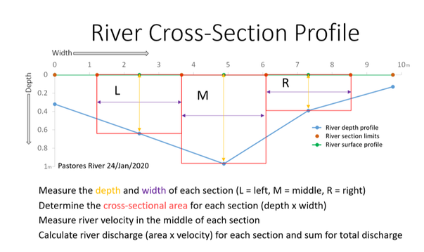
Stream flow measurements are taken every 15 days at the six rivers. To measure manual river discharge we measure the river cross-sectional profile (depth and width) and river velocity. A laser range finder is used to determine the river width and other distance parameters.
|
|
To measure the velocity, we use the float method and specialized instruments such as: a velocity meter, flow probe, and Acoustic Doppler Velocimetry (ADV).
Pressure river level loggers are installed at most of the gauges and measure continuous river level and temperature. From these measures we can estimate river discharge. A YSI Pro Plus is used to measure the physical parameters of the river water such as temperature, pH, dissolved oxygen (DO), total dissolved solids (TDS) and salinity. |
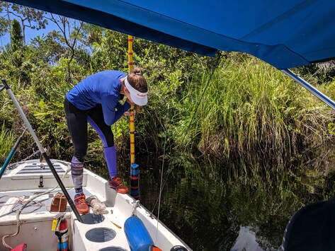
Ximena measuring river velocity with an ADV in the Black River. This river drains a peat swamp forest in San San Pond Sak.
|
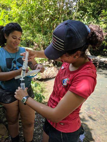
At Oeste River, Viviana filtering river water for nutrient analysis and Carolina is taking notes.
|
As part of this monitoring, we take water samples for nutrients in each river using a Van Dorn Bottle.
River samples are filtered onsite with a syringe filter system, kept on ice and then frozen. These water samples are analyzed for nitrogen, ammonium, and phosphorus concentrations. The concentration and river discharge are used to estimate river nutrient fluxes into Almirante Bay. |
Clark, K. E., Bravo Vergara, V. D., Giddings, S. N., Davis, K. A., Pawlak, G., Torres, M. A., Adelson, A. E., César, C. I., Boza, X., Collin, R. (2022) Land use and land cover shape river water quality at a continental Caribbean land-ocean interface, Frontiers in Water, 4, 1-19, doi:10.3389/frwa.2022.737920.